Satellite images show 10-km traffic jam before Crimean bridge
Satellite images from June 24 reveal a traffic jam over 10 kilometers long with about 1,500 vehicles before the Kerch (Crimean) bridge. Russian occupation authorities have intensified checks at checkpoints, while regular traffic suspensions due to rocket threats and drone attacks disrupt both civilian and military logistics.
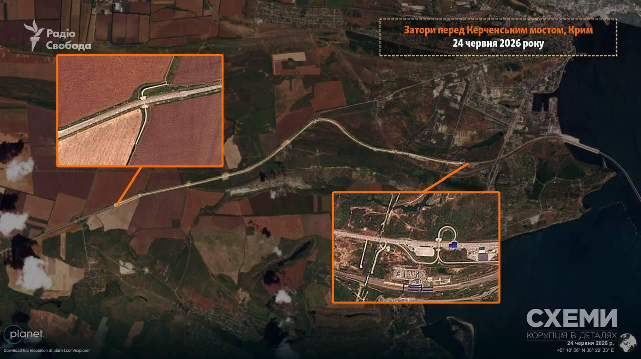
Satellite images released by the Radio Free Europe/Radio Liberty project "Schemes" on June 24 show a massive traffic jam before the Kerch bridge connecting Crimea to mainland Russia. The queue of vehicles stretches more than 10 kilometers, containing approximately 1,500 cars. The congestion begins at the checkpoint just before the bridge and ends near the village of Ivanivka in the Kerch district.
Traffic across the bridge is frequently halted due to rocket danger, air defense operations, or threats from Ukrainian naval drones. These suspensions, combined with tightened inspections by occupation authorities at checkpoints, are paralyzing both civilian and military logistics between the peninsula and Russia.
Amid a fuel crisis and power outages, more Crimean residents are posting on social media about their intentions to leave the peninsula.
Earlier in June, Ukrainian Defense Minister Mykhailo Fedorov predicted that the temporarily occupied Crimea would soon become isolated due to Ukrainian drone strikes. Meanwhile, Russian dictator Vladimir Putin ordered his government and the Ministry of Defense "to take measures to reduce to zero the consequences of AFU attacks" on infrastructure.