UN to vote on new world map accurately showing Africa's true size
The UN General Assembly will vote Friday on a resolution to phase out the Mercator map in favour of a projection that more accurately reflects Africa's actual size. The initiative is led by Togo with backing from the African Union.
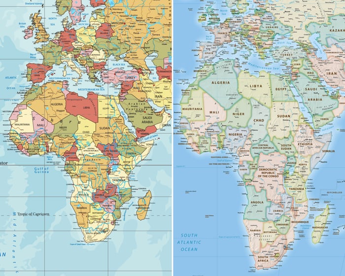
The United Nations General Assembly is set to vote on Friday on a resolution calling for the world to gradually move away from the traditional Mercator map toward a projection that more accurately shows the true scale of Africa. The resolution was put forward by Togo and is backed by all 54 other African Union member states, according to Togo's foreign affairs minister, Robert Dussey.
Dussey stressed that the matter is not political but scientific, pointing to established evidence that should be acknowledged. While UN resolutions carry no binding force, adoption could still influence school curricula and technologies that continue to rely heavily on the Mercator projection.
A centuries-old distortion
The Mercator projection was created in 1569 by Flemish cartographer Gerardus Mercator to assist sailors with navigation, and it has remained the dominant global standard ever since. However, due to how the projection works, regions near the equator appear much smaller than their actual size, while areas at higher latitudes appear larger. As a result, Africa appears roughly the same size as Greenland on the map, despite being 14 times larger than the Danish territory.
A Change.org petition tied to the #CorrectTheMap campaign, which has gathered more than 11,000 signatures, points out that the United States, China, India, Japan, Mexico and much of Europe could all fit within Africa's actual landmass with room left over. The African Union endorsed the campaign in August 2025 and asked Togo to lead efforts toward its adoption.
Historians and geographers have long argued that the Mercator projection reflects western-centric assumptions, with some activists using the term "cartographic colonialism." Critics argue the map has shaped global power perceptions by visually minimising the Global South.
An earlier alternative, the Gall-Peters projection, was introduced in 1973 by German historian Arno Peters. Togo's campaign, however, is promoting adoption of the 2018 Equal Earth map, developed by an international group of cartographers and regarded as a more accurate option.
JJ Enoch, a London-based senior associate at geopolitical risk advisory firm JS Held, said adopting an equal-area map would give a more accurate basis for education while signalling that Africa's importance should no longer be viewed through distorted, inherited conventions.
Togolese officials are hopeful given the outcome of a similar African Union-backed resolution in March, sponsored by Ghana, which described the slave trade as the "gravest crime against humanity" and was approved by 123 states. Should the map resolution pass, Togo plans to host an event in Lomé early next year with Unesco, the African Union and tech companies, including Google Maps, to plan its implementation.